Real data
Every point is a real licensed transmitter near the coast — not a mockup.
 SignalGround
3D Demo · Radio Frequency & Spectrum Management
This is licensed radio-frequency activity along the San Diego coast — marine VHF, coastal public-safety, port, and land-mobile transmitters — rendered volumetrically from live licensing data. The interactive view is shown one to one: tell us where you are and we will walk you through your own coastline, city or service territory.
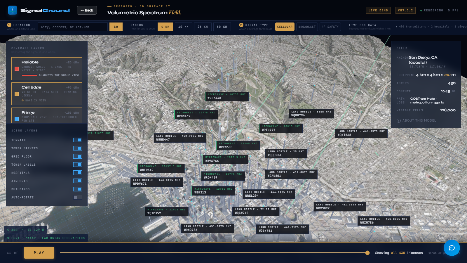
Real render of live FCC licensing data, San Diego coast, taken 2026-09-12.
Twenty minutes, screen-shared, on a location you choose. We answer questions as we go and leave you with the rendered view.
Every point is a real licensed transmitter near the coast — not a mockup.
Height and density show how busy the airspace is in three dimensions.
Marine VHF, port operations, and coastal public-safety spectrum in one view.
The same 3D view works for any US address — this is just one coastline.
Get SignalGround on Azure Marketplace → Back to site
The image above is a real render of live licensing data, not an illustration. The interactive view runs inside the SignalGround platform for signed-in customers and in guided demos.